
Micro Summary: Drone stockpile measurement in South Africa with 2% accuracy for financial audits. Non-intrusive volumetric surveys with zero site disruption.
The reason drone stockpile measurement exists is because the alternative is just a guess dressed up as a number. A person walking a stockpile with a GPS unit, or worse, an estimate based on truck counts, gets you a figure.
It doesn’t give you a figure anyone should sign off on for a financial audit or a production reconciliation. When balance sheets or compliance reports depend on those numbers then guessing becomes a liability.
I’m Sandile Shembe, founder of Innosa Projects. We’re an ECSA-registered engineering firm based in Rustenburg, and we run volumetric surveys across stockpiles, tailings, and bulk material sites for mining and industrial clients across South Africa.
We do this work because we know that the numbers going into a reconciliation report need to hold up to scrutiny. Just looking reasonable is not good enough.
How drone stockpile measurement works
Drone stockpile measurement uses a drone fitted with survey-grade photogrammetry or LiDAR sensors to capture the exact surface geometry of a stockpile from the air, then converts that data into a precise volumetric model.
Instead of estimating tonnage from a walked perimeter or a truck count, you get a measured volume, calculated from thousands of captured data points across the entire pile.
It turns “roughly how much is in that pile” into a number you can defend at audit.
A real example. Sappi, 15 stockpiles, two days.
We ran volumetric surveys across multiple coal stockpiles for Sappi’s KwaZulu-Natal facility, 15 stockpiles measured in two days, with volume accuracy within 2% for financial audit and production reconciliation. That project is a fair representation of what this looks like in practice. Measure fast, measure accurately, hand over a number that survives scrutiny.
Why manual stockpile estimates go wrong
Plants can change constantly, and documentation never keeps pace. Here’s what makes the figures slowly get skewed over the course of a plant’s life:
- Walked GPS surveys miss slope irregularities and undercuts.
- Truck-count estimates assume a consistent load weight that rarely holds in practice.
- Old survey data gets reused because re-measuring by hand is slow and disruptive.
- Compaction, moisture content, and pile reshaping between counts go unaccounted for.
- Different people measuring the same pile produce different numbers.
None of this is negligence. It’s what happens when the measurement method itself has a wide margin of error built into it. The number in the report was never as solid as it looked.
The drone stockpile measurement process
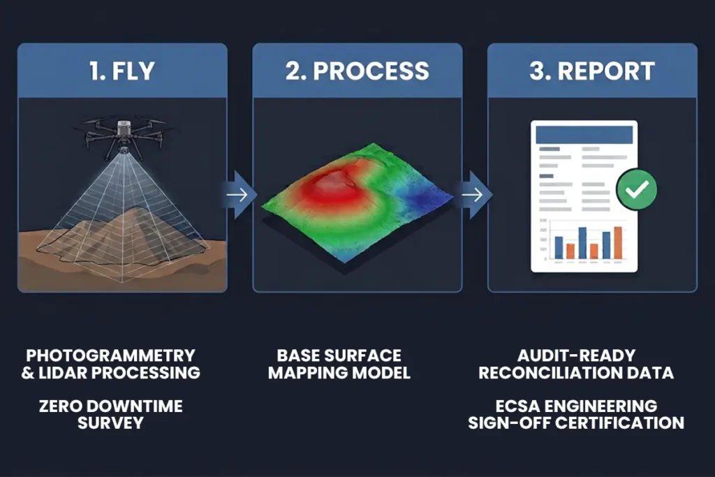
At Innosa, the process runs in three stages:
Fly.
A survey-grade drone captures the stockpile from multiple angles and altitudes, typically without any interruption to loading or offloading activity on site.
Process.
Captured imagery or LiDAR data is processed into a georeferenced 3D surface model and cross-checked for accuracy.
Volume is calculated against a defined base surface, and delivered as a report suitable for financial reconciliation, production audit, or stockpile management purposes.
Report.
If you have a stockpile reconciliation or audit deadline coming up, this is the point to act, not after the numbers are already in question. Talk to an engineer directly. We’ll get in touch within 24 hours to confirm the scope and timeline.
How accurate drone stockpile measurement really is
Accuracy depends on pile size, terrain, and flight parameters, but properly executed drone volumetric surveys using photogrammetry or LiDAR with ground control points typically achieve volume accuracy within 1-2% of true volume, well within the tolerance required for financial audit and production reconciliation purposes. That figure comes from cross-checking survey results against known reference points measured on site. It is the same verification method used across the industry to prove that a survey passes.
Disruption-free stockpile measurement for your operating site
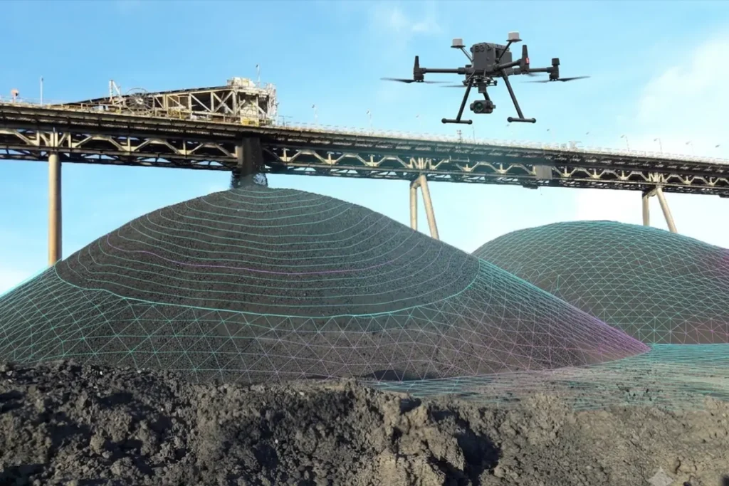
Volumetric analysis by drone is non-intrusive and is routinely carried out on active stockpiles during ongoing loading and offloading operations. This is usually the point where the conversation shifts from “can we fit this in” to “how often can we schedule it.”
Frequently asked questions
Is this only for mining, or does it apply elsewhere?
Mining is the most common application, coal, chrome, platinum ore, and other bulk material stockpiles, but the same method applies anywhere bulk material volume needs to be measured accurately: quarries, aggregate yards, agricultural bulk storage, and construction material stockpiles.
What is drone stockpile measurement?
It’s the process of using a drone with photogrammetry or LiDAR sensors to capture a stockpile’s exact volume, producing a measured figure suitable for financial audit or production reconciliation, rather than a walked or estimated figure.
How accurate is drone stockpile measurement?
Properly executed surveys routinely achieve volume accuracy within 1-2% of true volume. Request a quote and we’ll confirm expected accuracy for your specific site and pile type.
Does drone stockpile measurement interrupt loading or offloading operations?
No. Surveys are non-intrusive and are routinely carried out during active stockpile operations without halting production.
How often should stockpiles be measured?
This depends on your reconciliation and audit cycle, monthly, quarterly, or per audit period are all common. Talk to an engineer about a schedule that matches your reporting requirements.
Can this data be used for financial and production audit purposes?
Yes. Volumetric survey reports are produced specifically to support financial reconciliation and production audit requirements, with a defensible, dated measurement.
How do you know the drone measurement is actually accurate?
Ground control points, known reference measurements taken on site, are compared against the survey model. If the model matches the ground-truth points, the rest of the measurement is verified accurate to the same standard.
Is photogrammetry or LiDAR better for stockpile measurement?
Both can deliver the accuracy required for reconciliation purposes. LiDAR performs better on vegetated or low-texture piles, and photogrammetry is often faster to deploy on clean, well-lit stockpiles. Talk to an engineer about which fits your site.
Book drone stockpile measurement before your next reconciliation deadline, not after the numbers are questioned.
If a stockpile audit, financial reconciliation, or production report is coming up and your current numbers are based on a walked estimate, that’s the gap that costs credibility, not just accuracy.
Call +27 81 445 3066 or email info@innosaprojects.co.za. We’re based in Rustenburg and work nationally.
Choice of related article 1
Choice of related article 2
